

The Coastal Resilience of NYC (III)
By: Kyle Haynes
June 4, 2018
[In Part I of this four-part series, Virginia Tech’s Executive Master of Natural Resources (XMNR) alumni, environmental consultant, and sustainability professional Kyle Haynes began a conversation on the need for and reasons behind efforts to improve New York City’s coastal resilience, and Part II reviewed the impacts of recent hurricanes on NYC. The following installment presents four coastal protection strategies developed in response to recent hurricanes and their impact on NYC]
Coastal Protection Strategies
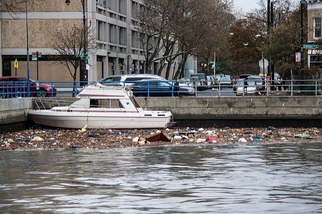
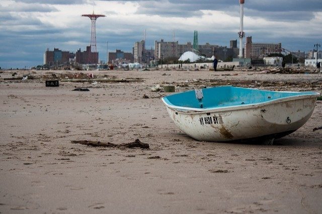
The greatest impact from Hurricane Sandy was from storm surge and the greatest risk going forward will continue to be storm surge. Storm surge is “the increase in water levels brought about by the low pressure and wind field of a coastal storm. When the surge comes into contact with a shoreline, it pushes additional water onto that shoreline, often inundating large inland areas. Sandy’s surge had an incredibly destructive impact on the coastline of New York City.”
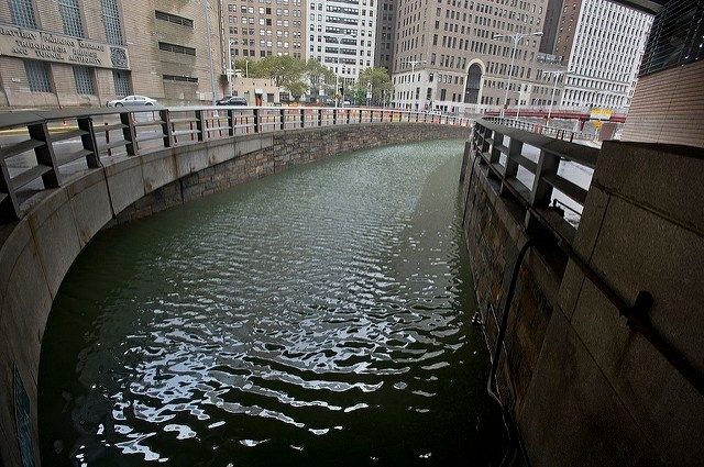
One of the most effective ways to minimize the impact of storm surge is through the implementation of multiple lines of defense. It is impossible to eliminate the chance of flooding in coastal areas, but the City will seek to reduce its frequency and effect.
As described in A Stronger, More Resilient New York the City’s plan for coastal protection focuses not on retreat but instead focuses on the following four strategies:
- Increasing coastal edge elevation
- Minimizing upland wave zones
- Protection against storm surges
- Improving coastal design and governance.
Each strategy has numerous types of best management practices that will be implemented throughout the city that are listed below each strategy.
Strategy 1 – Increase Coastal Edge Elevations. The city proposes to increase the height of vulnerable coastal edges with bulkheads, beach nourishment, and other measures. This is an adaptive strategy and allows for gradual investment where the needs arise.
Beach Nourishment: These projects are a critical part of the City’s coastal defense network. Regular wave action and the natural sediment transport process continue to erode beaches over time. Storms accelerate this process. Therefore, a regular beach nourishment program, which adds sand to widen and elevate beaches regulatory (and after storms) is critical to allow beaches to serve an important coastal protection role.
Armor Stone (Revetments): This method encompasses the hardening of exposed shorelines with stone, or revetments with rip-rap to protect the shoreline from erosion caused by storms and sea level rise. This strategy is a proven coastal protection method and can also help raise edge elevations. (A Stronger, More Resilient New York)
Bulkheads: Bulkheads are usually made of stone or concrete, at the water’s edge and have been installed to hold shorelines in place. They are also used to protect exposed shorelines from erosion. The city has proposed to raise bulkheads in targeted locations citywide that would mitigate the effects of rising sea levels in low-lying areas shown to be prone to future tidal flooding.
Tide Gates/Drainage Devices Tide Gates: These commonly used devices can be used to improve the performance of the city’s drainage network and reduce flood risk, though they must be evaluated on a site-specific basis so as not to impede the ability of upland areas to drain stormwater.
Strategy 2 – Minimize Upland Wave Zones. Storm waves, which are projected to increase in size and strength over time, threaten to cause neighborhood damage, erosion, and the loss of beach sand in vulnerable areas. To address this risk, the City will work to provide significant attenuation of waves—that is, to knock down waves, or diminish their velocity— both off and onshore, before they reach neighborhoods. This approach will reduce potential damage to structures, reduce erosive forces on the shoreline, and protect infrastructure.
Dunes: These are reinforced sand mounds typically located along the back edge of a beach designed to help break waves and keep floodwaters from inundating neighborhoods. Dunes can be “sacrificial,” designed to allow sand to wash away as storm waters recede.
Offshore Breakwaters: These features are typically composed of rock or other materials located in an ocean or bay designed to attenuate wave energy offshore, absorbing the force of destructive waves before they reach the coast and adjacent neighborhoods. By calming nearby waters, these structures also can provide new habitat for in-water organisms such as oysters. Although expensive, offshore breakwaters can reduce risks significantly for areas exposed to significant wave action and erosion.
Wetlands, Reefs, and Living Shorelines Wetlands: Wetlands are areas that are inundated or saturated by surface or groundwater sufficiently frequently to support vegetation that thrives in wet soil conditions. Reefs are an offshore feature typically below sea level. Living shorelines are coastal edges that incorporate a combination of reefs, breakwaters, maritime or coastal forests, and tidal wetlands to reduce wave action and erosion.
Groins: These are installations of rocks or timber, perpendicular to the shoreline, and are often referred to as jetties. They can help retain sand from beach nourishment projects on-site and also serve to break waves and absorb wave energy.
Strategy 3 – Protect Against Storm Surge. To address the risk of storm flooding, the City will work to keep water from storm surge out of vulnerable neighborhoods and away from critical infrastructure. To do this, the City will use flood protection structures, such as floodwalls, levees, and local storm surge barriers built, where possible, to the 100-year flood elevation with an additional allowance for the future sea level rise. The City will seek measures that minimize damage if overtopped.
Integrated Flood Protection Systems: Flexible and adaptable, integrated flood protection systems are composed of a variety of elements that can be combined and customized in areas where critical infrastructure or vulnerable neighborhoods require a high level of flood protection.
Floodwalls/Levees Floodwalls: These are permanent vertical barriers and are designed to provide a higher level of surge protection for vulnerable neighborhoods and critical infrastructure, attenuating waves and blocking surge.
Local Storm Surge Barriers: Local storm surge barriers consist of large movable in-water gates and connecting levees or floodwalls on adjacent shores. These barriers are constructed in navigable water bodies to allow for normal maritime commerce and boating in non-storm conditions. However, the barriers also can be closed in advance of an extreme weather event to protect the inland neighborhoods behind them.
Multi-Purpose Levees: Multi-purpose levees function much like a simple levee but play additional roles, serving, for example, as transportation infrastructure, providing parking, supporting residential, retail or commercial uses, or serving as open space. In certain high-density locations, multi-purpose levees can serve not only as flood protection for adjacent neighborhoods but also can provide a cost-effective mechanism to pay for coastal protection by creating land for development, which is also elevated and thus itself not at risk of flooding.
Strategy 4 – Improve Coastal Design and Governance. The City will make improvements to the design and governance of coastal areas. More specifically, the City will study how natural areas and open space can be used to protect neighborhoods and improve quality of life. The City will work to manage its waterfront assets more effectively, while also developing partnerships to improve permitting and study innovative coastal protections.
[In the final installment of this series, scheduled for publication on June 11th, Haynes presents lessons learned from the planning and strategy efforts of NYC to increase coastal resilience.]
___

Virginia Tech’s Executive Master of Natural Resources (XMNR) alumni (2017) Kyle Haynes is an environmental consultant and sustainability professional with over 8 years of experience in natural resource management. As a consultant, he leads environmental studies for transportation and infrastructure projects throughout the mid-Atlantic. Additionally, he is a certified Envision Sustainability Professional and Virginia DEQ Combined Administrator in Stormwater Management and Erosion and Sediment Control. Kyle also has a BS in Geography from Radford University.
The Center for Leadership in Global Sustainability thanks the following photographers for sharing their work through the Creative Commons License: MTA; drpavlov; Roman Iakoubtchik; and drpavlov.
References
- A Stronger, More Resilient New York. 2013. NYC Special Initiative for Rebuilding and Resiliency. <http://s-media.nyc.gov/agencies/sirr/SIRR_singles_Lo_res.pdf> accessed December 2016.
- Coastal Resilience. 2016. <http://coastalresilience.org/about/> accessed December 2016.
- New York’s Resilience Challenge. 2016. <http://www.100resilientcities.org> accessed December 2016.
- National Oceanic and Atmospheric Administration (NOAA). 2016. What is Resilience? <http://www.oceanservice.noaa.gov> accessed December 2016.
- OneNYC. 2016. <http://www1.nyc.gov/site/lmcr/background/background.page> accessed December 2016.
- McPhearson, T. 2016. Wicked problems, social-ecological systems, and the utility of systems thinking. The Nature of Cities. <https://www.thenatureofcities.com/2013/01/20/wickedproblems> accessed December 2016.
- Rebuild By Design. 2016. <http://www.rebuildbydesign.org/our-work/all-proposals/winning-projects/big-u> accessed December 2016.